
About
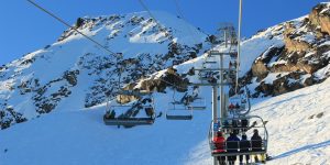
The Garibaldi at Squamish project is a proposed year-round destination mountain resort on Brohm Ridge, 15 km north of Squamish on Highway 99. It is 80 km north of Vancouver and 45 km south of Whistler. The project has been approved, tentatively, with 40 conditions and includes 124 ski trails and 21 lifts, plus resort accommodation and commercial developments. The project developers estimate that 900 construction jobs to build the project and 2500 jobs during operation will be created and the resort will take 20 years to build.
Learning Accomplishments
Gaining practical knowledge of operating Arc GIS. Especially, with elevation models where I learned TIN (Triangular Irregular Network) system as well as getting to know orthophoto. We can exaggerate Z scale and make elevation difference more significant than the reality. This can be a way to trick people and when it's used, we should mention it. Also, I learned how to conduct a 3D spatial analysis using Arc GIS's "aspect" function. How data BC have data for ecological habitats and its usefulness when conducting Environmental Impact Assessment. .
Analysis
1/3 of the proposed area is not skiable
Snowline is estimated to elevate up to 600m, and Garibaldi Ski Resort's 31.7% of the proposed project area is in elevation lower than 600m.
| Total Project Area (m2) | 54717275.03 |
| Skiable Area (Above 600m elevation) (m2) | 17388592.78 |
| Not Skiable Area within Project Boundary | 31.7% |
Impact on ecology
Mule deer and Mountain goat habitat will cover 7.8% of the entire ski resort.
Old growth forest will cover 6.7%
Fish-bearing streams or riparian area will cover 28.7%
In sum, 38.9% of the ski resort will be located in the ecological habitat and would impact them severely.
| Total Project Boundary Area (m2) | 54717275.03 | ||
| Ungulate Habitat | Old Growth Forest | Riparian Habitat | |
| Area (m2) | 4315158.89 | 3710331.43 | 15702701.55 |
| Share within the project boundary | 7.89% | 6.7% | 28.7% |
Mule deer and Mountain goat habitat will cover 7.8% of the entire ski resort.
Old growth forest will cover 6.7%
Fish-bearing streams or riparian area will cover 28.7%
In sum, 38.9% of the ski resort will be located in the ecological habitat and would impact them severely.
Contention
If I were a natural resource planner and have been hired by the municipality of Squamish as an independent consultant to assess this ski resort development, I would write the following letter.
Letter
To Municipality of Squamish
I estimated the environmental impact of Garibaldi Ski Resort based on the spatial analysis by GIS and I claim the project is not worthwhile. In this letter, I will denote how I came to this conclusion.
First, I analyzed the ecological status within the project boundary. Three types of unique biomass reside inside the boundary: Ungulate winter range, Old growth forests, and Riparian habitat. These are highly fragile environmental entities that establishing a ski resort would severely impair the natural status. Furthermore, those highly fragile areas account for roughly 40% of the whole Garibaldi Ski Resort. Especially, rivers are located within the area quite extensively, covering up to 29% of the project area. Furthermore, modifying one river means, changing the whole river network in a broader framework; it can change the sediment load which leads to unpredictable hazards like a more frequent landslide, and also the river ecosystem would
incur severe damage. Accordingly, constructing the ski resort in this highly ecologically active area can have an overwhelming impact.
Secondly, the global warming trend would push the snowline to the higher elevation (at around 600m), and a decrease in snowfall amount would be present on the west coast of British Columbia. What this means for Garibaldi Ski Resort is a shorter season and less skiable years in the future. The resort consists of 32% below the snowline, so the skiable area is constrained fairly. Also, the resort will not be completed for another 20 years, and the global warming trend is worsening, so that snowline could elevate even more.
One thing I can propose is that the logging roads already existing in the project boundary can help the construction remarkably and avoid wasteful cutting of the forest. Roads are extensively distributed which even goes up to the higher elevation.
In this analysis, I derived the biomass data (Ungulate range, Old growth forest and Riparian habitat) from Data BC, and for landscape data, I used TRIM data (rivers, roads etc.). For further investigation, I recommend field research as well as economic feasibility; by conducting the field research, we will have a much better understanding of the topology, ecology and hydrology of the area. Also, economic feasibility needs to re-examine with the acknowledgment of environmental cost; those animals and life affected by the construction need to be calculated in the cost of the resort. Furthermore, after 20 years once the project is completed, snowfall might decrease dramatically due to climate change, and it can end up in the financial and ecological nightmare. Many predictable climate-related variables might change the course of this resort. Overall, Garibaldi Ski Resort might bring more problems than what it can offer.
Data
In this project, I used the Digital Elevation Model (DEM) as well as various ecological biomass data (rivers, old growth forest, and winter ungulate range) as the input. I downloaded from Data BC. Also, I used TRIM data for roads and 20m contours. Detail below,
| Filename | Description | Data Source | Search Terms |
| BTM (LU_BTM_92G_V) | General Landuse data (converted from raster to vector | HectaresBC | N/A |
| User Created (UWR) | Ungulate Winter Range | DataBC | Ungulate Winter Range |
| User Created (OGMA) | Old Growth Management Areas | DataBC | Old Growth Management Areas (legal) |
| Project_Boundary.shp | Project Boundary | G:Drive and on the website | N/A |
| DEM_92g14 | Digital Elevation Model (BC 1:250,000 scale) | G:Drive | N/A |
| Park_Boundaries | Parks and Protected Areas Boundary | G:Drive | N/A |
| * TRIM_tctrl | 20 m contours | G:Drive | N/A |
| TRIM_troad | Roads | G:Drive | N/A |
| TRIM_trivr | Rivers | G:Drive | N/A |
*TRIM data accessed from UBC library.
Calculation>
1. SnowlineThe area below 600m (17388592.78 m²)/ Total Area (54717275.03m²) = 0.317, thus approximately 31.7% of the project area is below 600 m
2. Winter Ungulate Range within the project boundary
672972.82 + 795059.16 + 633817. 56 + 216009.58+ 259762.27 + 1737537.47 = 4315158.89 m²
thus, 6.78% of the proposed project area has old growth forest
Learning Significance